One of today’s major environmental problems is the increase in illegal waste dumping in forests, rivers, river banks and other remote areas. In addition, waste in rivers causes damage not only locally, but also downstream, both in the watercourses and washed ashore. It is estimated that approximately 80% of marine plastic pollution originates from riverine sources, with annual plastic discharge into marine environments from rivers globally ranging between 1.15 and 2.41 million metric tons. Our research aims to examine, test and develop various robust waste detection methods for identification of illegal waste dumps using high and medium resolution remote sensing imagery along the Tisza River and other watercourse in the Carpathian Basin, supporting the waste collection actions of the Plastic Cup Initiative (PET Kupa). Prolonged observations conducted by Hungarian water authorities have documented instances on the Tisza River wherein the prevalence of floating bottles reaches rates as high as 500 bottles per minute, thereby earning the moniker “plastic flood” and rendering the Tisza River among the most polluted tributaries of the Danube.
The developed methodology separates 3 categories for plastic waste detection:
- Identification of hot-spots, i.e. illegal waste dumps from which significant amounts of waste are discharged into the river during flooding.
- Identifying upstream river blockages that can form at known locations in the river (e.g. hydroelectric power stations).
- Detection of waste, mainly plastic, dumped in known locations in the floodplain.
Advancements in Earth observation satellites furnished with medium- and high-resolution multispectral sensors have been substantial over the past decade. The availability of multitemporal imagery for designated regions at monthly, weekly, or even daily intervals facilitates change analysis. These multispectral datasets afford the opportunity for analysis encompassing both visible and non-visible spectral domains, as well as diverse indices derived thereof, thereby enhancing the discrimination of waste-laden areas from their surroundings. The goal of this research is to devise a precise classification approach aimed at identifying plastic waste, with the ultimate aim of establishing a reliable framework for systematic, economical, and extensive monitoring. The development of such a resilient monitoring system holds the potential to accelerate the identification of illicit waste accumulation sites in proximity to water bodies, along with floating debris masses within riverine contexts. Furthermore, it stands to bolster waste management efforts through the implementation of an automated surveillance mechanism.
Plastic waste detection
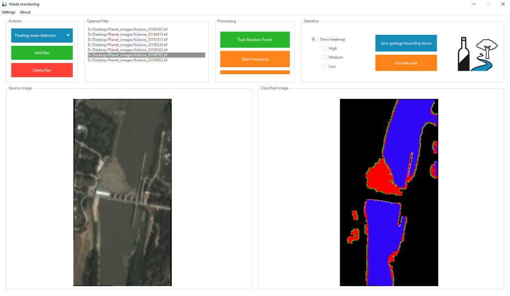
Currently, the project primarily operates with a Random Forest machine learning model. As a secondary solution we have also trained a U-NET++ Convolutional Neural Network for the task and further approaches (e.g. Support Vector Machines) are also under development. The implementation is written in Python. As for now, the project mainly depends on the following data sources:
- The publicly available and free, medium resolution Sentinel-2 multispectral satellite imagery.
- The high resolution PlanetScope multispectral satellite imagery, through an educational and research grant.
Flood prediction
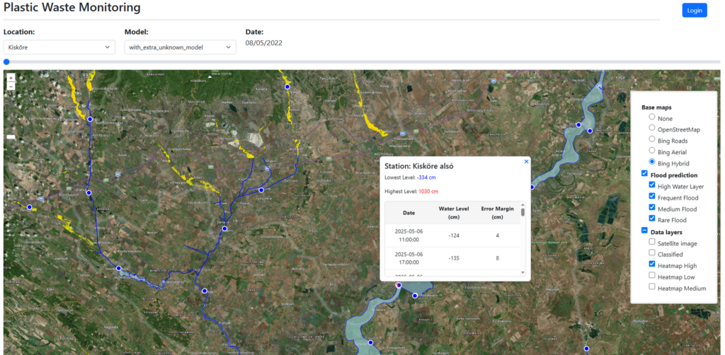
For practical applicability the developed application also integrates with water level and flood prediction data provided by Hungarian authorities. Historical, current and predicted water levels for designated measurement points are provided by the Hungarian Hydrological Forecasting Service (OVSZ), while flood zone maps were provided by the General Directorate of Water Management (OVF).
Gallery


Interactive demonstration
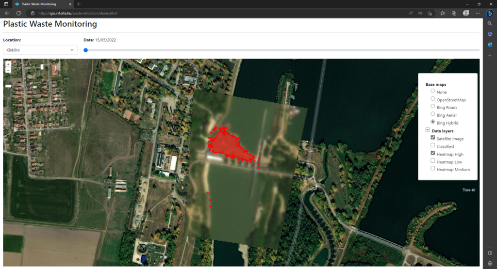
Interactive visualization of the automated satellite imagery processing and plastic waste detection:
https://gis.inf.elte.hu/waste-detection/
Source code availability
Public project (published developments): https://github.com/GISLab-ELTE/WasteDetection
University project (unpublished developments): https://gitlab.inf.elte.hu/gislab/waste-detection
Publications
- Attila D. Molnár, Kristóf Málnás, Sára Bőhm, Miklós Gyalai-Korpos, Máté Cserép, Tímea Kiss: Comparative Analysis of Riverine Plastic Pollution Combining Citizen Science, Remote Sensing and Water Quality Monitoring Techniques, Sustainability, vol. 16 (12), art. 5040, 2024. DOI: 10.3390/su16125040
- Dávid Magyar, Máté Cserép, Zoltán Vincellér, Attila D. Molnár: Waste Detection and change Analysis based on Multispectral Satellite Imagery, In Proceedings of KEPAF, art. 53., p. 18., 2023. DOI: 10.48550/arXiv.2303.14521
Theses
- Gőgös Márton: Vízparti és vízfelszíni hulladékszűrés műholdfelvételeken normalizációs és változásdetektáló módszerekkel, MSc diplomamunka, 2025.
- Dénes Botond: Vízközeli hulladéklerakók megbízható detektálása multispektrális műholdfelvételek segítségével, TDK dolgozat, 2024.
- Magyar Dávid: Hulladék-detektálás és változáselemzés folyóvizeken multispektrális műholdfelvételek alapján, TDK dolgozat, szakdolgozat, 2022.
