Description
The goal of our research is to develop an accurate classification
method for plastic waste detection to provide a viable platform for
repeatable, cost-effective and large-scale monitoring. Such a robust
waste monitoring solution would speed up the detection of illegal
waste hot-spots close to water flows and floating waste islands on
rivers, as well as support waste collection actions with an automatic
monitoring system. This application automatically searches for newly
recorded satellite images and downloads them on a daily basis. After
this a
Random Forest or a
U-NET++ Convolutional Neural Network
model classifies the pictures and displays the results in the web
view. You can check out the extension of polluted areas on the set
locations in the previous five days when the cloud cover over them was
below a threshold (15%).
Features
-
Location:
You can choose from four previously set locations:
Kisköre,
Lake Călinești,
Pusztazámor,
Рахів
and
Visegrád (Drina)
-
Date:
It can be changed using the swipe. You can select from the last
five most recent days when the cloud cover over the areas was
below a threshold (15%).
-
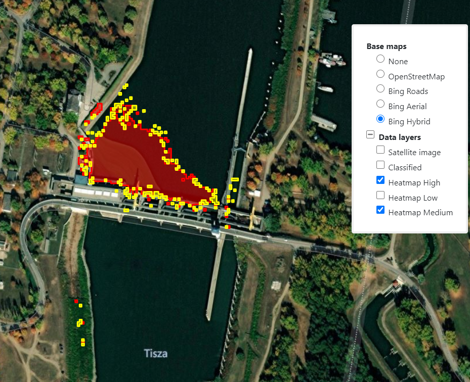
Colors:
-
Classified:
Orange. All pixels that were classified as plastic waste.
-
Heatmap High: Red. Pixels that were classified as plastic waste with a
confidence of 90% or higher.
-
Heatmap Medium:
Yellow. Pixels that were classified as plastic waste with a
confidence between 80% and 90%.
-
Heatmap Low:
Green. Pixels that were classified as plastic waste with a
confidence below 80%.
-
Flood prediction:
Visualize flood hazard areas (with probability of flooding), water
mark locations and their water level predictions. Functionality is
based on integrated national data services. (Available for Hungary
in the demo app.)