
The primary goal of the project is to process high-density and precision point clouds created by airborne laser scanning (ALS) for surface classification, object detection and reconstruction. In the case of multitemporal recordings, a change analysis can also be performed, e.g. in terms of vegetation or the built environment. The results can be used among others in the fields of urban planning, environmental protection and disaster management.
The implementation is carried out in C++, using the Geospatial Data Abstraction Library (GDAL) software library.
For this research, we primarily use the publicly available, multitemporal, Dutch AHN point clouds to test our algorithms. The main features of this point cloud dataset are:
- covered area: 41.526 km2 (The Netherlands)
- average point density: 6-10 point / m2
- accuracy: 5cm
- dataset size: 20TB / recording
We also work with the national Estonian point clouds.
Interactive demonstration
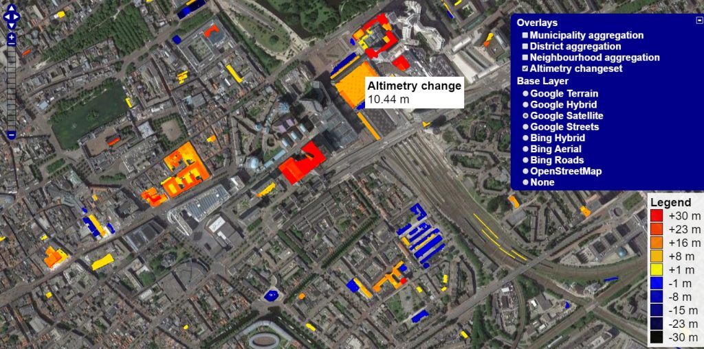
Interactive visualization of changes in buildings and vegetation:
https://gis.inf.elte.hu/ahn/
Source code availability
Public project (published developments): https://github.com/GISLab-ELTE/PointCloudTools
University project (unpublished developments): https://gitlab.inf.elte.hu/gislab/cloudtools
Publications
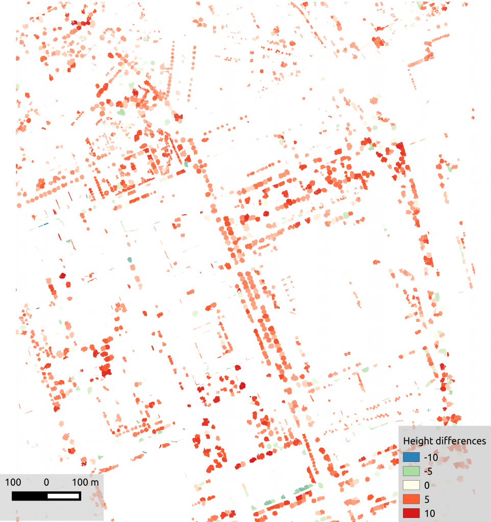
- Máté Cserép, Roderik Lindenbergh: Distributed processing of Dutch AHN laser altimetry changes of the built-up area. International Journal of Applied Earth Observation and Geoinformation, vol. 116, art. 103174, p. 12, 2023. DOI: https://doi.org/10.1016/j.jag.2022.103174
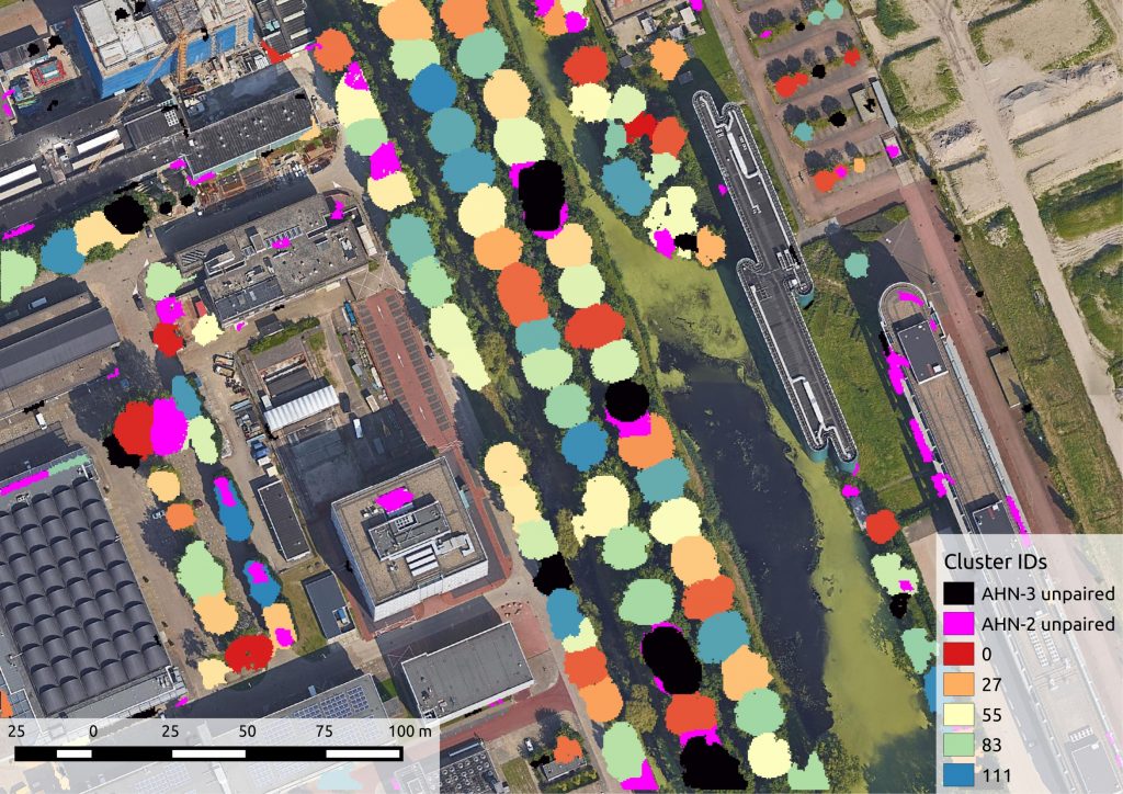
- Anett Fekete, Máté Cserép: Tree segmentation and change detection of large urban areas based on airborne LiDAR, Computers & Geosciences, vol. 156, art. ID: 104900, 2021. DOI: https://doi.org/10.1016/j.cageo.2021.104900
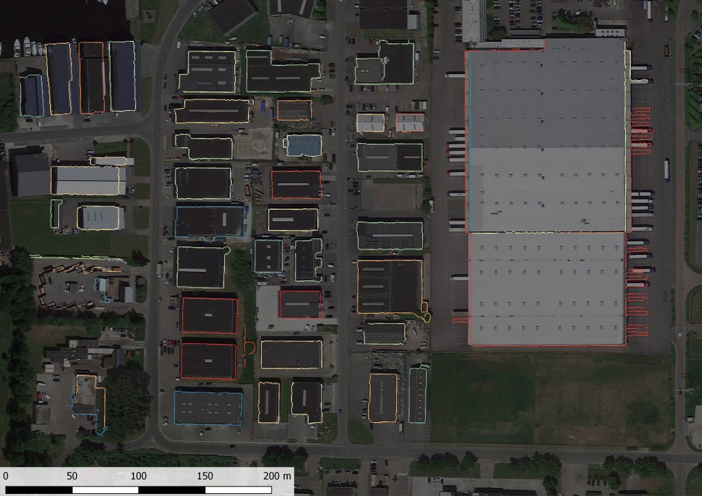
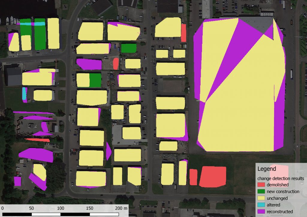
- Mátyás Pitlik: Contour-based building recognition and change detection from LiDAR data, TDK thesis, 2019.
- Anett Fekete: Change Detection of Vegetation Based on LiDAR Data, TDK thesis, 2019.
- Máté Cserép, Roderik Lindenbergh: Distributed processing of Dutch AHN laser altimetry changes, In Proceedings of the 2nd Virtual Geoscience Conference, Norway, 2016, ISBN: 978-82-8361-004-8